
Strand Maps
Map Design
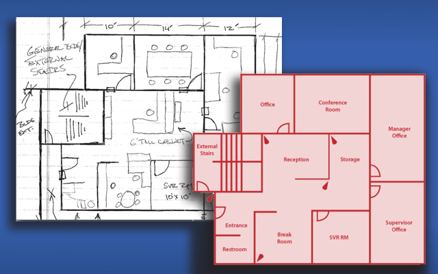
Strand’s industry leading Site Replicator redefines the way physical floor plans are utilized by replicating key mapping elements and placing them into a customized, consistent image. Rather than PDFs or large graphics, Strand utilizes PNG or SVG files to maximize system performance. Real time images are viewed in conjunction with strategically placed camera icons to better acclimate the viewer to the mapped environment.
Read more about Map Design Services
